The ancient world was a diverse and complex place, full of different cultures, languages, and religions. Understanding the geography of this world is crucial to understanding the events and stories of the Bible. Thankfully, Bible Maps offers a wealth of interactive resources that can help you explore this fascinating world in more depth.
One of the most useful features of Bible Maps is the ability to explore the lands of the Old and New Testaments. From the deserts of Egypt to the mountains of Armenia, you can follow the journeys of the patriarchs, prophets, and apostles as they traveled through these ancient lands. The maps are interactive, allowing you to zoom in and out and click on specific locations to learn more about their history and significance.
For example, if you want to trace the journey of the Israelites from Egypt to Canaan, you can follow their route on the Exodus Route Map. This map shows the possible locations of Mount Sinai, as well as the various stopping points along the way, such as the Red Sea, Marah, and Rephidim. By following the Israelites on this journey, you can gain a deeper understanding of the challenges they faced and the miracles that God performed on their behalf.
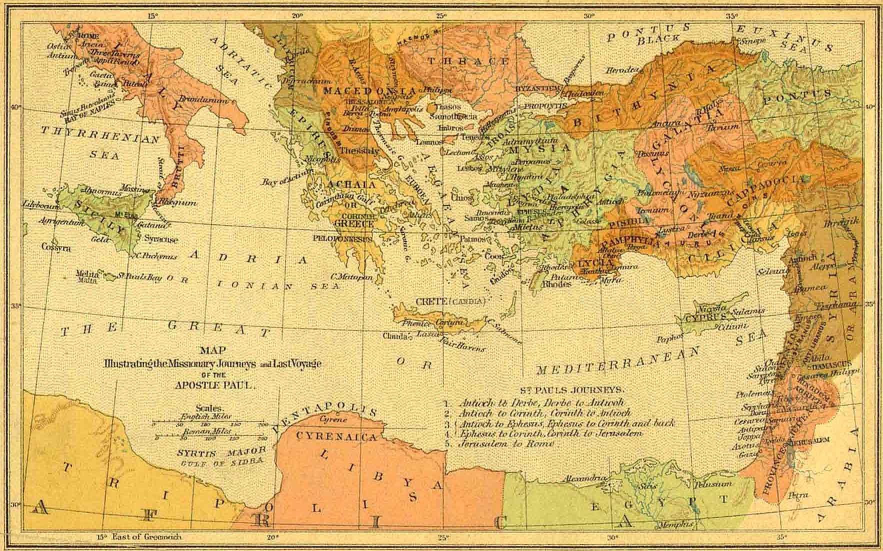
Similarly, if you want to explore the world of the New Testament, you can use the maps to follow the travels of the apostle Paul. From his hometown of Tarsus to the cities of Ephesus, Corinth, and Rome, you can see where Paul preached, established churches, and encountered opposition. This can help you understand the social and political context of Paul's ministry and the challenges he faced as he spread the gospel throughout the ancient world.
Another useful feature of Bible Maps is the ability to compare the geography of the Bible with modern-day maps. This can help you understand how the landscape has changed over time and how the ancient world differs from the world we know today. For example, you can compare the boundaries of Israel in the time of the judges with the modern-day borders of Israel, or you can see how the course of the Jordan River has changed over the centuries.
Bible Maps offers a valuable tool for exploring the geography and history of the Bible. By using these interactive maps, you can gain a deeper understanding of the ancient world and the stories that took place there. Whether you're a student, scholar, or simply interested in learning more about the Bible and its cultural significance, Bible Maps is the perfect resource for enhancing your studies and expanding your perspective.